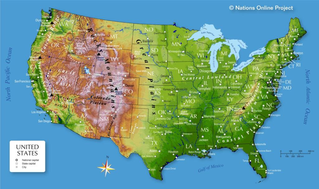
As a lake homeowner, you’re probably familiar with the concept of topography. It refers to the study of land surfaces, which encompasses various features such as mountains, hills, valleys, and bodies of water. When looking at lake areas, one common element of their topography is the presence of water. But beyond the existence of a lake, some lake areas share similar topography. Across the U.S., there are common types of topography in each section of the country. Today, we’re diving into some of the characteristics of lake topography by region!
The West
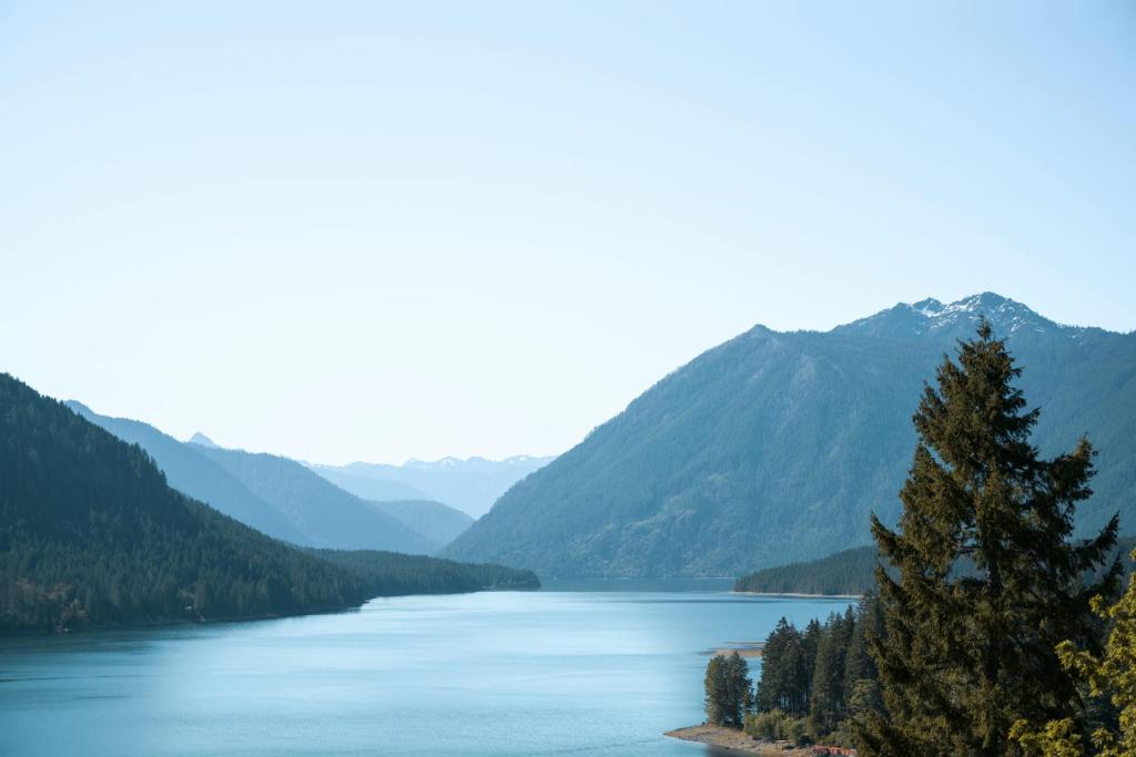
When imagining the western part of the United States, the most salient topographical feature that comes to mind is probably a mountain. This is because the Rocky Mountains, America’s largest mountain chain, stretches across this region. The states of Washington, Oregon, and California are home to many of the earth’s youngest mountains. In particular, the Cascade mountain range is only about a million years old. In some of our most popular lake areas in the west, you’ll notice that mountain features are common. For instance, Washington’s Lake Chelan is surrounded by the Chelan Mountains, and Oregon’s Crater Lake is on Mount Mazama, an inactive volcanic mountain.
The Great Plains
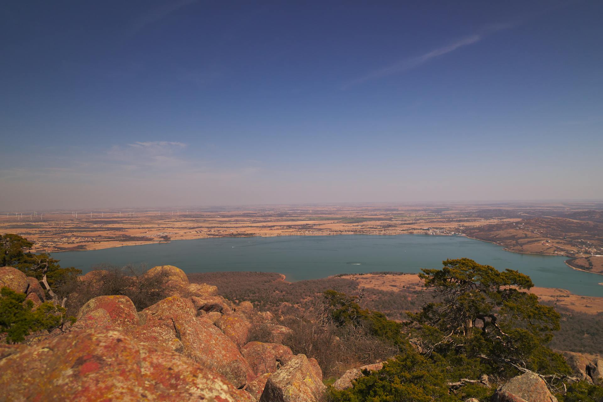
Also known as the “breadbasket” of North America, the Great Plains region refers to the middle of the continent. Think: Texas, Oklahoma, Kansas, Nebraska, and other surrounding states. This region’s topography is characterized by fertile soil, which formed during the most recent ice age. The result is a series of states full of native grassland prairies. So, when it comes to lakes in the Great Plains region, expect to find vast stretches of land for miles. For instance, popular lakes such as Oklahoma’s Lake Lawtonka, the oldest man-made lake in the state, are surrounded by a desert-like landscape.
Central Lowlands
Similar to the Great Plains region, the Central Lowlands were also impacted by the last ice age. This region covers northern states in the mid-U.S., such as Minnesota, Wisconsin, Illinois, Indiana, and Ohio. Because the melting ice sheets from this glacial period flattened the existing topography of this region, much of the Central Lowlands is flat with rolling hills. The most impressive result of this “glacial scouring” is the Great Lakes. Extending more than 1300 feet below sea level, Lake Superior and others are an impressive outcome of this piece of geographic history.
Atlantic Coast

Alongside the coast of the Eastern U.S., the states that border the Atlantic Ocean share similar ecosystems and in turn, similar topographies. One defining feature of this region’s topography is the Appalachian Mountain Range. This massive range extends 2,000 miles from Canada to central Alabama. Additionally, the climate of this eastern region is characterized by wetlands and marshes. These moist land features lend themselves to a lush topography full of natural lakes and vibrant greenery. For instance, North Carolina’s Lake Rhodhiss, at the foothills of the Blue Ridge Mountains, is known for its gorgeous natural shoreline surrounded by miles of trees. Down in Florida, Lake Eloise and other parts of the Lakeland/Winter Haven area are extremely moist, with several citrus groves.
In every region of the country, there’s something to celebrate about the unique topographies of our lakes!